 ar
ar bg
bg hr
hr cs
cs da
da nl
nl fi
fi fr
fr de
de el
el hi
hi it
it ko
ko no
no pl
pl pt
pt ro
ro ru
ru es
es sv
sv tl
tl iw
iw id
id lv
lv lt
lt sr
sr sk
sk sl
sl uk
uk vi
vi et
et hu
hu th
th tr
tr fa
fa ms
ms hy
hy ka
ka ur
ur bn
bn mn
mn ta
ta kk
kk uz
uz ku
ku
water gauge water level gauge
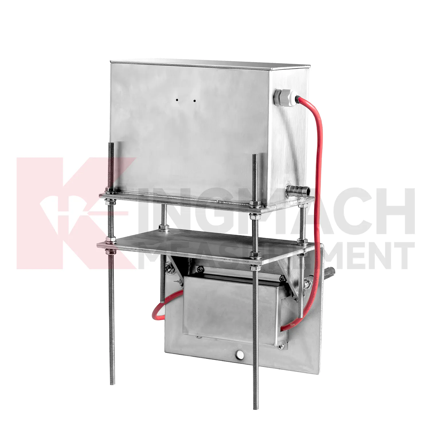
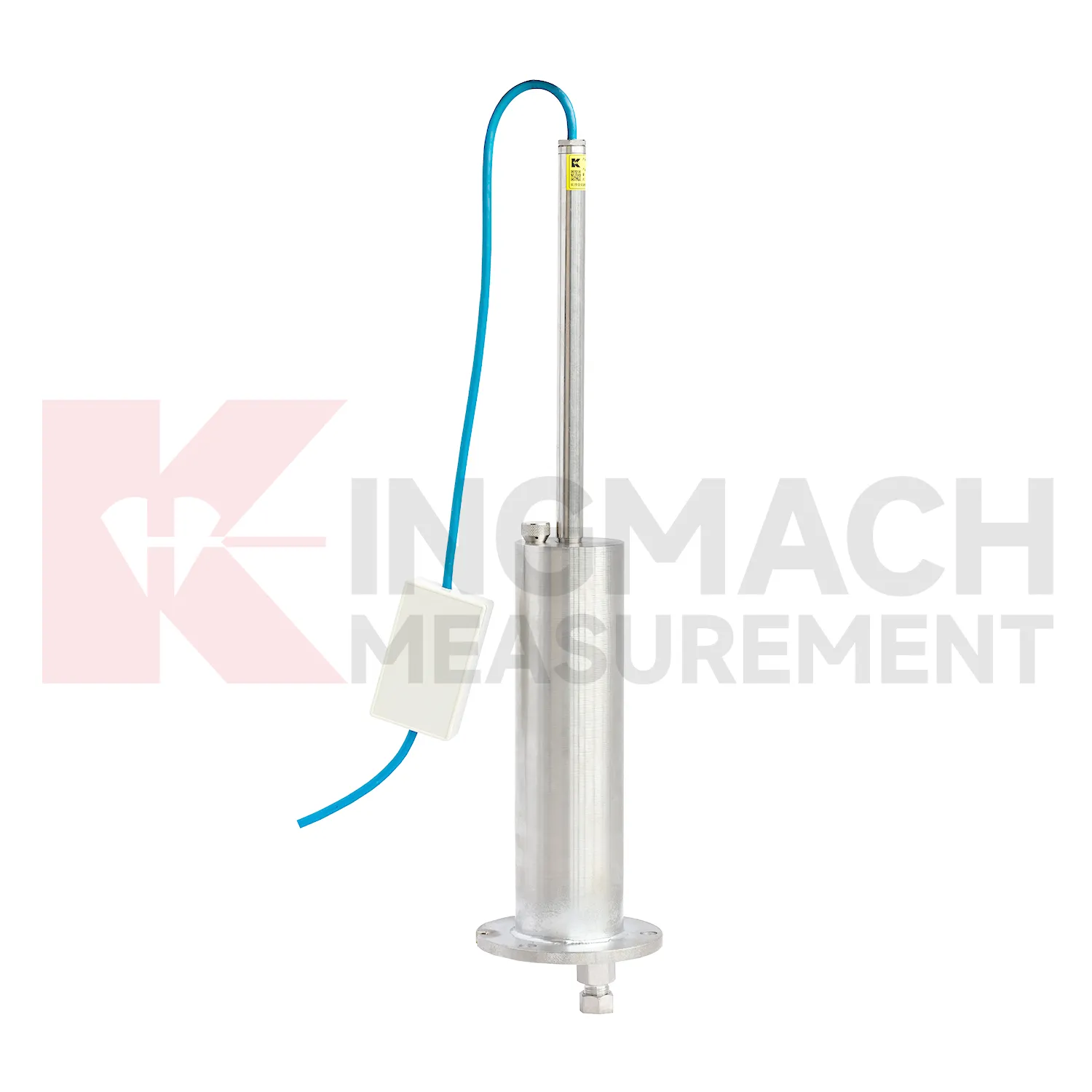
Kingmach water gauge water level gauge include the JMDL-62XXADT inductive frequency-modulated hydrostatic level sensor for projects that need a hydrostatic reference network rather than isolated manual checks. The instrument is arranged with connecting tubes, so each measuring location works against a shared liquid level and a stable reference point. Listed ranges are 50 mm, 100 mm, and 200 mm, with 0.01 mm resolution, 0.5%FS accuracy, RS485 output, DC 9V to 24V supply, power consumption below 0.5W, and an operating temperature from -30 degrees Celsius to +80 degrees Celsius. It is applied in dam deformation observation, bridge deflection, slope stability, building settlement, and high-speed rail foundation monitoring. A good project layout starts with the reference benchmark, tube slope, exhaust position, cabinet height, cable route, and channel address. During commissioning, the crew should remove trapped air, confirm fluid continuity, record the initial level, and compare every channel under the same temperature condition. The data cabinet can then collect each channel by address and preserve a clear relation between tube branch, instrument serial number, and drawing location. This makes later data easier to judge because a curve change can be traced back to a named measuring point, a known hydraulic path, and a documented baseline.
Application of water gauge water level gauge
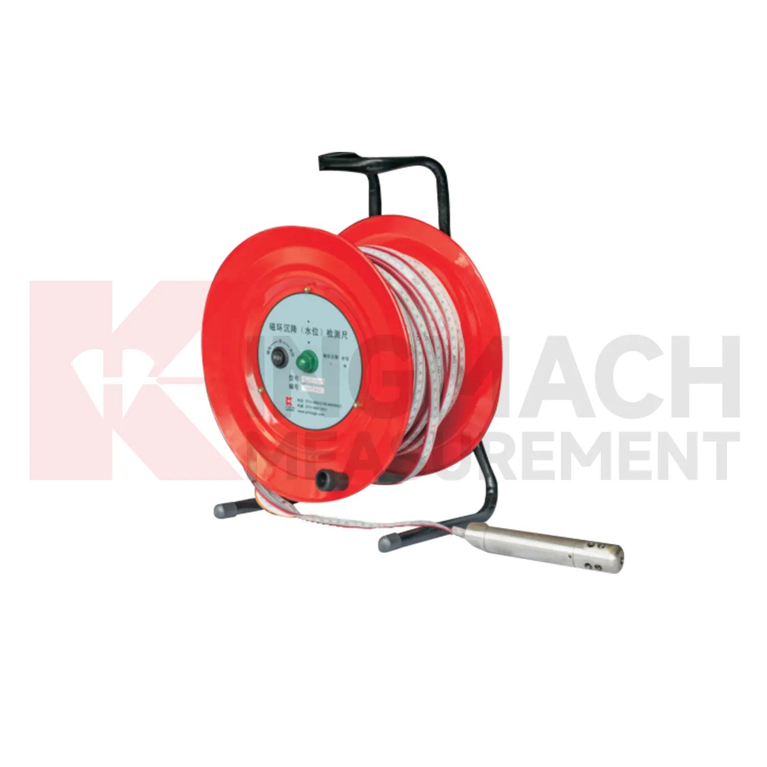
In foundation pit projects, water gauge water level gauge are used during staged excavation to track base uplift, nearby pavement settlement, groundwater response, and vertical movement around retaining systems. The timing of each value matters because deformation may change after dewatering, support installation, soil removal, rainfall, or backfilling. Kingmach JMDL-47XXAT can be embedded to follow base uplift or local settlement, while JMCJ-1003/1005 can read magnetic ring depth and groundwater level in boreholes. Hydrostatic instruments may be added where several elevations around the pit need comparison against a reference. The site team should record excavation depth, support level, water pumping condition, adjacent road or building observations, and first stable baseline beside the settlement curve. If movement grows quickly, the response should include checking the sensor and reference first, then comparing support force, wall displacement, groundwater, and visual inspection before deciding whether excavation can continue. This keeps settlement review tied to the actual construction sequence, which is essential because a pit may behave differently at each excavation depth and support stage. A clear record also helps distinguish base rebound from surrounding ground loss or reference disturbance. The review file should also include reference condition, recent site work, nearby sensor behavior, and inspection notes so later teams can interpret the curve clearly.
The future of water gauge water level gauge
The future of water gauge water level gauge will also depend on better installation kits. Many settlement errors begin with field details: a tube is kinked, a plate is disturbed during compaction, a ring depth is recorded poorly, a cable exits at the wrong place, or a reference point is not protected. Future products can reduce these problems with clearer connectors, pre-labeled cables, stronger side-exit protection, better probe markings, and commissioning checklists. Kingmach JMDL-47XXAT already uses side-exit cable routing to avoid pavement compaction interference, and hydrostatic systems rely on clean tube installation. Better installation accessories will make the first baseline more trustworthy. In settlement monitoring, a clean start is often more useful than a later attempt to correct a poor record. The practical goal is to keep settlement data understandable after the original installation crew has left, so owners can compare old and new readings without reconstructing the field history from memory. The same record should remain readable for designers, contractors, owners, and maintenance teams, because settlement monitoring often continues long after the first construction report is finished.
Care & Maintenance of water gauge water level gauge
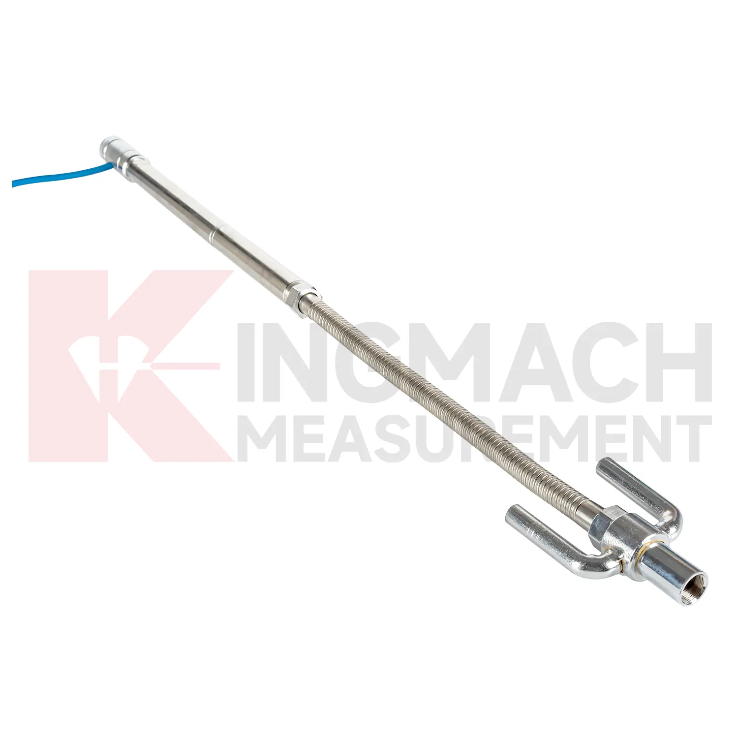
Embedded water gauge water level gauge such as JMDL-47XXAT require protection during earthwork, paving, and later traffic. The settlement plate, measuring rod, metal flexible conduit, anchor head, extension rod, bottom anchor, and side-exit cable should be installed without being bent or crushed by compaction equipment. Record installation depth, gauge length, cable exit point, fill layer, protection cover, and first stable reading before the point is buried. During maintenance, inspect accessible cable sections, junction boxes, cabinet terminals, and any area where later excavation may have disturbed the line. If a curve changes after a filling stage or pavement operation, compare the timing with construction logs before judging the ground response. Buried parts are difficult to inspect after coverage, so photographs, as-built sketches, and cable route notes become part of the working instrument. Good embedded-point care is mostly quiet prevention done before damage becomes visible.
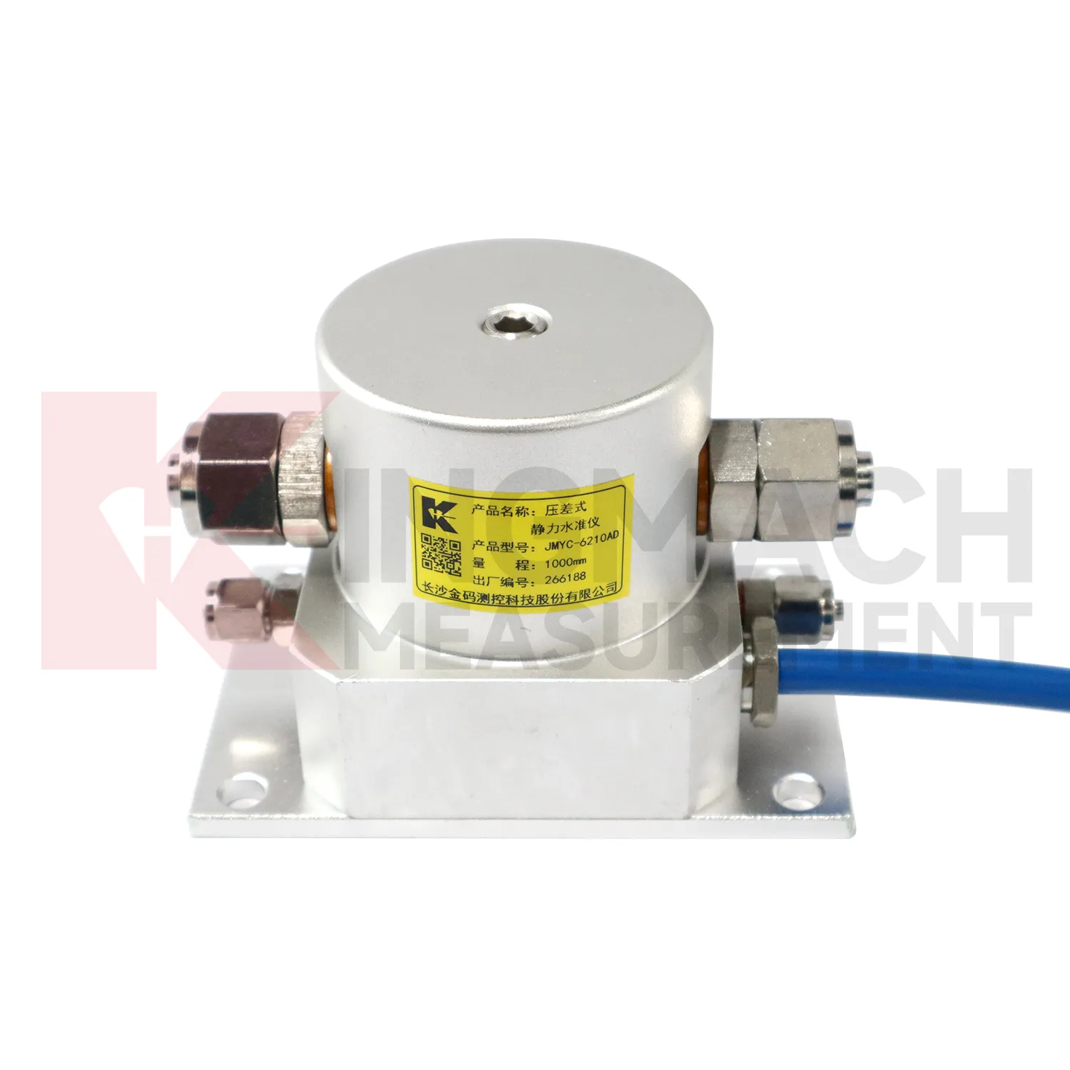
Kingmach water gauge water level gauge
Wide-area settlement monitoring needs water gauge water level gauge that can handle larger travel and uneven profiles. Kingmach JMYC-62XXAD wide-range differential pressure hydrostatic level sensors are designed for pavement settlement, cross-sectional nonlinear settlement, soft foundation treatment, land reclamation foundations, dam subgrades, slope stability, bridge deflection, and building settlement. The listed range extends from 500 mm to 4000 mm, with 0.1 mm resolution and 0.2%FS accuracy. This makes it different from micro range sensors used for smaller deflection changes. A long road or reclamation section should not be judged by one point only. The value comes from comparing a profile over time, then linking that profile with filling stage, surcharge timing, drainage records, groundwater, and site inspection notes. This is especially important when several instruments share one cabinet or when hydrostatic tubes, embedded rods, and manual borehole readings appear in the same project. This is especially important when several instruments share one cabinet or when hydrostatic tubes, embedded rods, and manual borehole readings appear in the same project.
FAQ
Q: What does JMDL-47XXAT measure?
A: It measures in-situ subgrade settlement, embankment heave, foundation pit base uplift, tunnel bottom uplift, dyke compression, and pile foundation settlement.
Q: What ranges are listed for JMDL-47XXAT?
A: The listed ranges are 100 mm, 200 mm, 300 mm, and 400 mm, with 0.01 mm resolution on the 100 and 200 mm models and 0.1 mm on larger models.
Q: How is the gauge installed?
A: It uses a settlement plate, electrical displacement sensor, measuring rod, metal flexible conduit, anchor head, extension rod, and bottom anchor head.
Q: Can traffic operation continue during monitoring?
A: The side-exit cable routing is designed to avoid interference with pavement compaction and can support monitoring during traffic operation when installed correctly.
Q: What should be recorded during installation?
A: Record plate position, anchor depth, extension length, cable route, baseline, model, range, and construction stage.
Reviews
Matthew Garcia
Instrumentation cables are durable and perform well even in harsh environments. Will definitely order again.
Michael Anderson
The strain gauges and load cells are extremely accurate and stable. They performed very well in our bridge monitoring project. Highly recommended!
Latest Inquiries
To protect the privacy of our buyers, only public service email domains like Gmail, Yahoo, and MSN will be displayed. Additionally, only a limited portion of the inquiry content will be shown.
Mia***@gmail.comNetherlands
Dear team, we are interested in your readouts & data loggers compatible with multiple sensors. Do yo...
Isabella***@gmail.comGermany
Hello, we are evaluating weir flow meters for a water management project. Please share accuracy deta...
Related product categories
- hydrostatic level sensor
- hydrostatic level sensor price
- hydrostatic liquid level sensor
- hydrostatic pressure level sensor
- hydrostatic pressure sensor level measurement
- hydrostatic level sensor principle
- hydrostatic level sensors
- hydrostatic pressure level sensors
- Wide-Range Differential Pressure Hydrostatic Level Sensor
- Inductive Frequency-Modulated Hydrostatic Level Sensor
- water level gauge
- water gauge water level gauge