 ar
ar bg
bg hr
hr cs
cs da
da nl
nl fi
fi fr
fr de
de el
el hi
hi it
it ko
ko no
no pl
pl pt
pt ro
ro ru
ru es
es sv
sv tl
tl iw
iw id
id lv
lv lt
lt sr
sr sk
sk sl
sl uk
uk vi
vi et
et hu
hu th
th tr
tr fa
fa ms
ms hy
hy ka
ka ur
ur bn
bn mn
mn ta
ta kk
kk uz
uz ku
ku
gnss settlement sensors
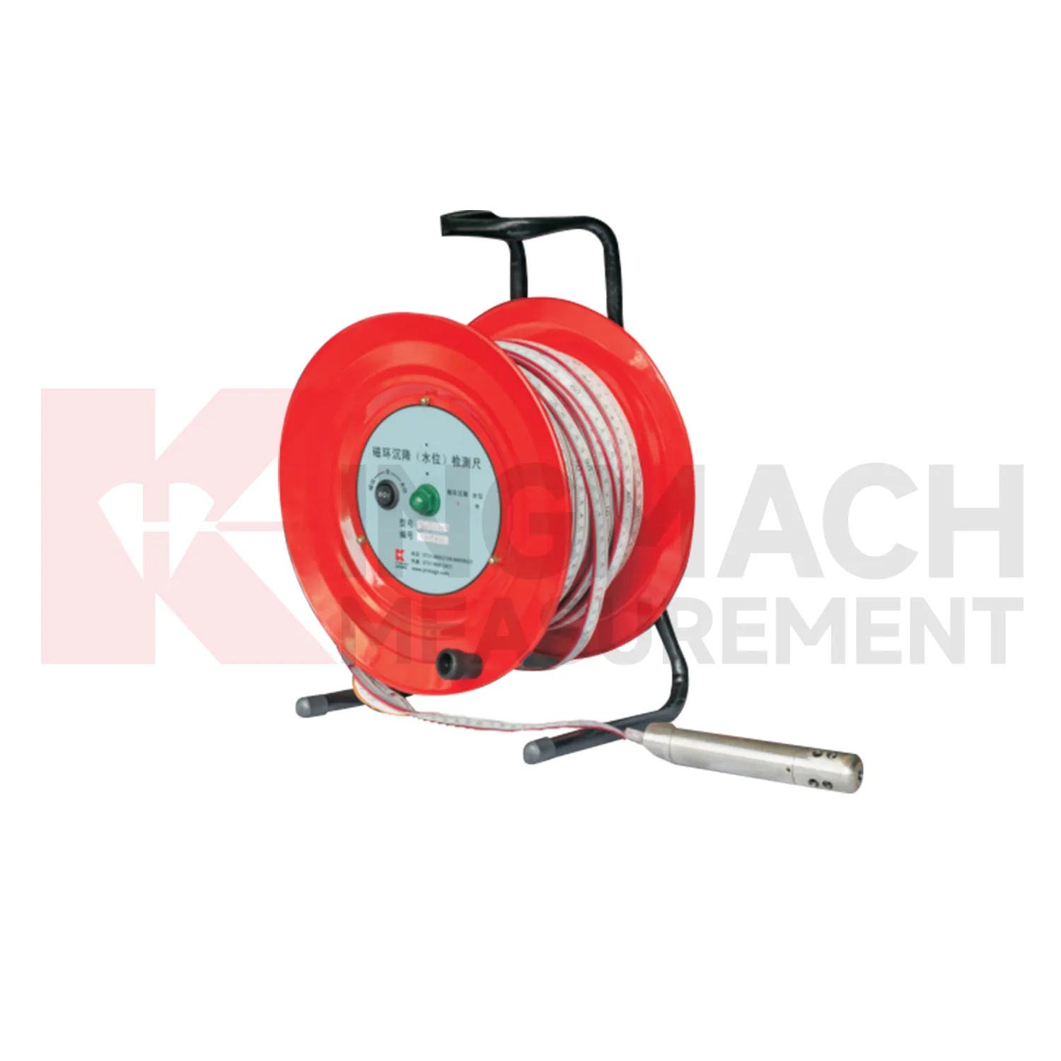
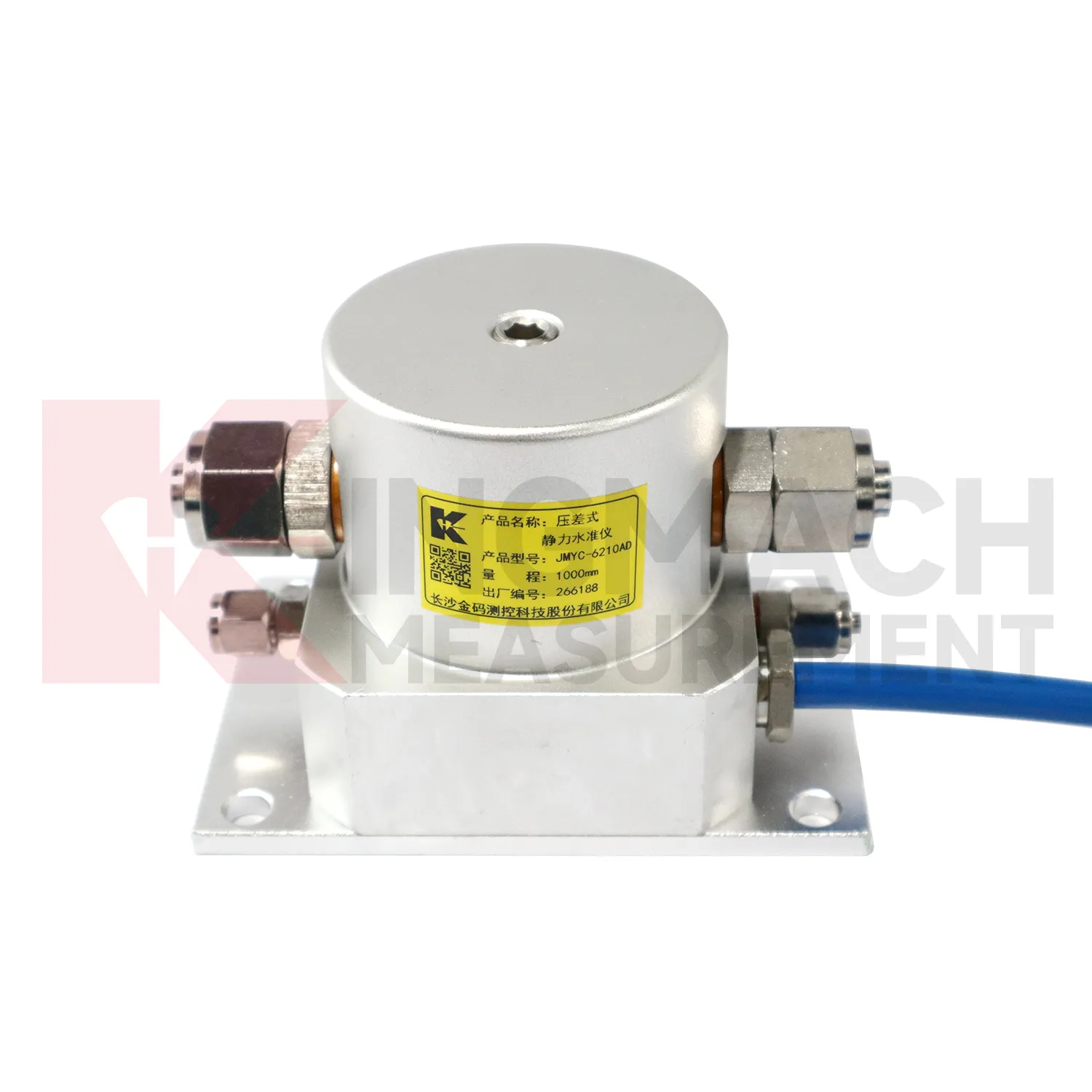
Kingmach gnss settlement sensors also cover the JMQJ-62XXADT micro range hydrostatic level sensor, a compact instrument for small vertical deformation where fine reading stability matters more than large travel. The product page lists 50 mm and 100 mm ranges, 0.01 mm resolution, 0.5%FS accuracy, RS485 digital signal, DC 9V to 24V power, power consumption below 0.4W, IP68 protection, about 4.5 kg weight, temperature drift of plus or minus 0.001 mm per degree Celsius, and annual stability of plus or minus 0.1%FS. Typical sites include tunnels, subgrades, dams, bridges, slopes, and building foundations. Because the measuring span is small, installation quality has a strong effect on the usefulness of the readings. The installer should keep the mounting surface firm, shield the cable gland from standing water, protect the pipe connection, and label each sensor before cabinet wiring. Acceptance should include zero confirmation, response comparison between nearby locations, enclosure inspection, and a saved baseline table. For wet galleries, buried sections, or tunnel invert areas, the IP68 enclosure and low power demand help the instrument remain practical when access is limited. This model fits monitoring programs where gradual millimeter-scale movement must be recorded through long wet or buried service conditions.
Application of gnss settlement sensors
In bridge deflection and pier foundation monitoring, gnss settlement sensors help engineers follow vertical behavior that may change with traffic, temperature, bearing response, scour, or foundation compression. Kingmach JMQJ-62XXADT micro range hydrostatic level sensors provide 50 mm and 100 mm ranges, 0.01 mm resolution, RS485 output, and IP68 protection for small movements near decks, piers, or abutments. JMDL-62XXADT hydrostatic sensors can connect several measuring points through tubes, allowing a bridge team to compare related locations against a common reference instead of reading each point alone. A practical layout may place sensors near pier caps, bearing seats, approach slabs, or foundation observation positions, depending on the risk being tracked. The daily review should not look at the settlement curve by itself. Traffic loading, temperature swing, inspection findings, bearing condition, river level, and nearby structural instruments give the curve meaning. If a pier point drifts while the deck and approach slab stay stable, the cause is different from a whole-span temperature response. Clear naming, stable reference control, and consistent reading intervals turn small vertical changes into usable maintenance evidence.
The future of gnss settlement sensors
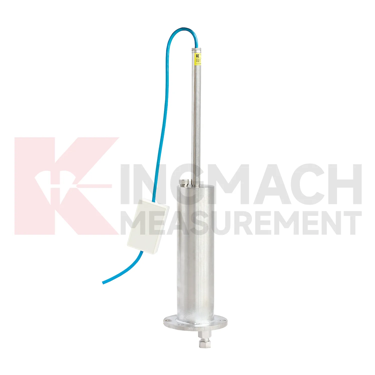
The future of gnss settlement sensors will include cleaner digital handover records. Settlement monitoring often lasts longer than the construction team stays on site, so owners need more than a table of values. A useful handover file should include model, serial number, range, reference point, tube route, ring depth, baseline, installation photo, cable tag, borehole number, and first stable reading. Kingmach products such as JMDL-47XXAT and JMCJ-1003/1005 especially benefit from this because embedded rods, magnetic rings, anchors, and borehole readings may be hard to inspect later. When that information is stored with the curve, maintenance teams can understand why a point was installed and how its settlement should be interpreted years later. Future records should make the instrument history as visible as the measurement itself, so old readings can still be trusted after staff changes, repairs, and new construction stages.
Care & Maintenance of gnss settlement sensors
Replacement or recalibration of gnss settlement sensors must preserve continuity in the settlement record. Do not overwrite earlier data or silently move the zero value. Record replacement date, reason, model, range, serial number, reference point, first stable reading, and any change to cable, tube, cabinet, borehole, or mounting setup. If a hydrostatic reference point is moved, explain how old and new readings should be compared. If a magnetic ring borehole is repaired, note whether depth references changed. If an embedded gauge is abandoned, mark the point status clearly in reports instead of leaving a silent gap. Settlement monitoring often matters because it lasts for years, so maintenance events must be visible to future reviewers. A clean handover file should let a new engineer understand not only the curve, but also every instrument event that shaped it.
Kingmach gnss settlement sensors
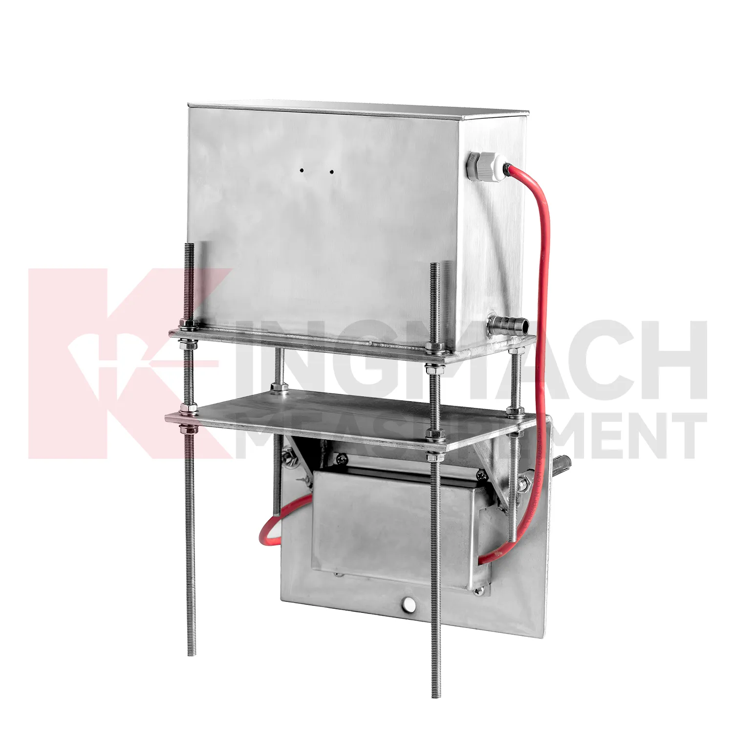
For procurement and technical selection, gnss settlement sensors should be matched to expected movement scale, access, and monitoring method. A micro range hydrostatic sensor with 0.01 mm resolution is not the same tool as a wide-range differential pressure sensor covering up to 4000 mm, and neither replaces a magnetic ring gauge used for borehole layer readings. Kingmach's category includes JMDL-47XXAT, JMDL-62XXADT, JMQJ-62XXADT, JMYC-62XXAD, and JMCJ-1003/1005, each aimed at a different settlement task. Before ordering, engineers should define whether the point is embedded, connected by water tube, manually probed, remotely acquired, or compared with a reference sensor. The best specification starts with the field question, then selects the instrument. Procurement teams should therefore ask not only for range and accuracy, but also for installation method, reading method, protection level, and data handover format. Procurement teams should therefore ask not only for range and accuracy, but also for installation method, reading method, protection level, and data handover format.
FAQ
Q: How should gnss settlement sensors be maintained?
A: Check reference points, tubes, cables, seals, settlement plates, anchors, probes, cabinets, and channel names at planned intervals.
Q: Should zero values be reset casually?
A: No. A reset can hide real settlement. If a reset is necessary, record the reason, time, old baseline, and new baseline.
Q: What data should be reviewed with settlement?
A: Rainfall, groundwater, excavation depth, filling stage, traffic loading, tilt, displacement, strain, and load data can all help explain settlement changes.
Q: What signs suggest a data issue?
A: Flat lines, sudden jumps after maintenance, impossible values, repeated communication gaps, or disagreement with nearby points may indicate instrument or data-chain problems.
Q: What makes a settlement report useful?
A: A useful report includes point location, model, range, baseline, reference point, latest reading, cumulative settlement, rate of change, and field notes.
Reviews
James Thompson
The tiltmeters and accelerometers are very sensitive and provide precise data. Perfect for our structural health monitoring system.
Joshua Clark
We ordered a full monitoring solution including sensors and data loggers. Everything works seamlessly together. Great supplier!
Latest Inquiries
To protect the privacy of our buyers, only public service email domains like Gmail, Yahoo, and MSN will be displayed. Additionally, only a limited portion of the inquiry content will be shown.
Harper***@gmail.comIndia
Dear Sir, we are planning to procure a complete monitoring system including strain gauges, tiltmeter...
Mia***@gmail.comNetherlands
Dear team, we are interested in your readouts & data loggers compatible with multiple sensors. Do yo...
Related product categories
- Wide-Range Differential Pressure Hydrostatic Level Sensor
- Inductive Frequency-Modulated Hydrostatic Level Sensor
- water level gauge
- water gauge water level gauge
- water gauge level
- gauge water level
- Magnetic Ring Settlement Water Level Gauge
- Optical Deflection Monitor
- Tilt Sensor
- Deflectometer
- Micro Range Hydrostatic Level Sensor
- Single-point Settlement Meter