 ar
ar bg
bg hr
hr cs
cs da
da nl
nl fi
fi fr
fr de
de el
el hi
hi it
it ko
ko no
no pl
pl pt
pt ro
ro ru
ru es
es sv
sv tl
tl iw
iw id
id lv
lv lt
lt sr
sr sk
sk sl
sl uk
uk vi
vi et
et hu
hu th
th tr
tr fa
fa ms
ms hy
hy ka
ka ur
ur bn
bn mn
mn ta
ta kk
kk uz
uz ku
ku
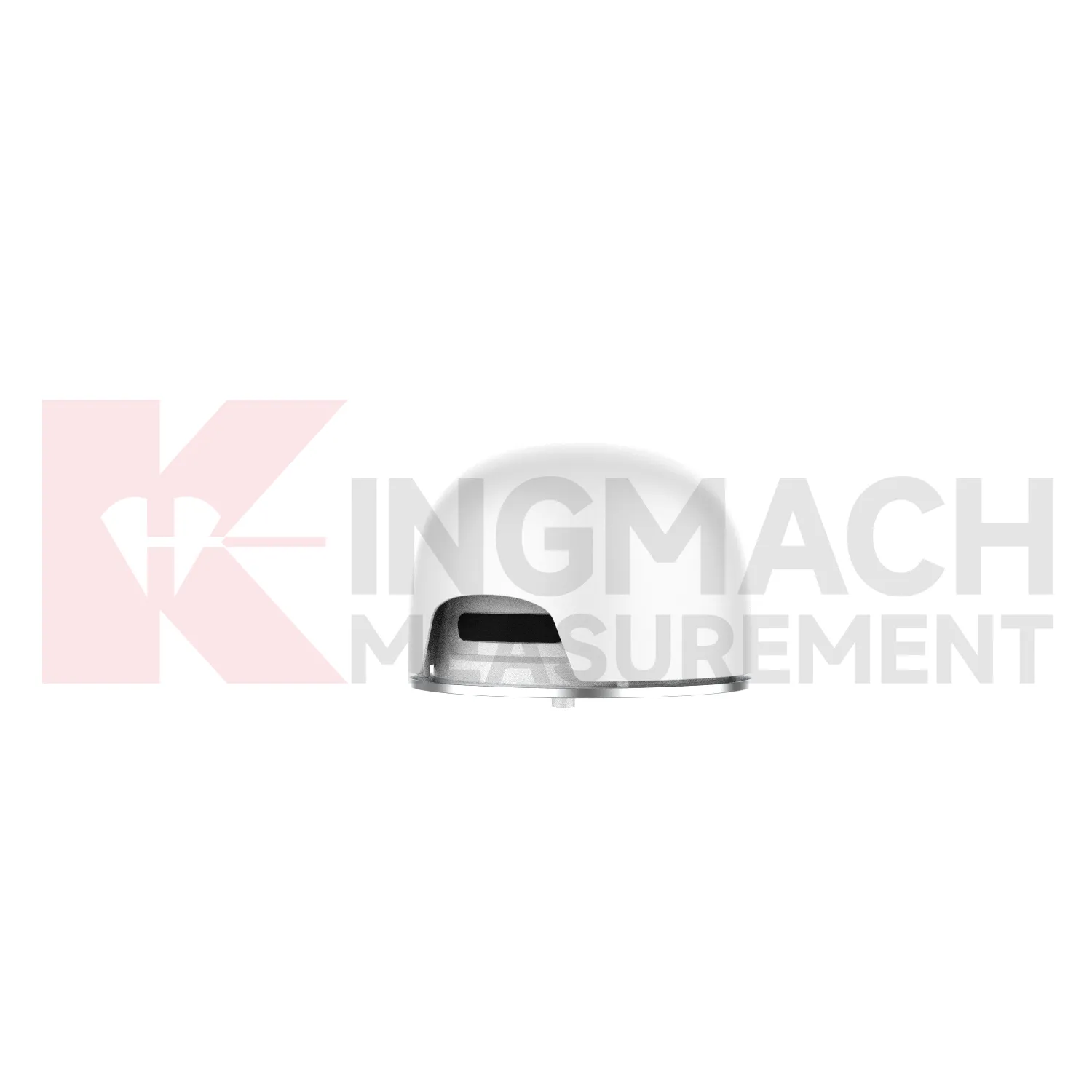
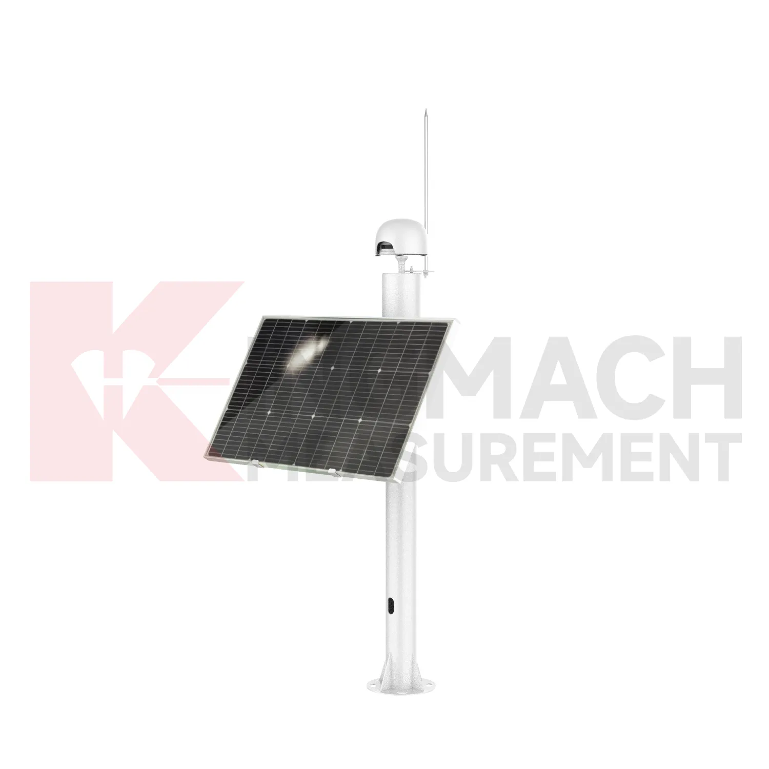
Integrated GNSS
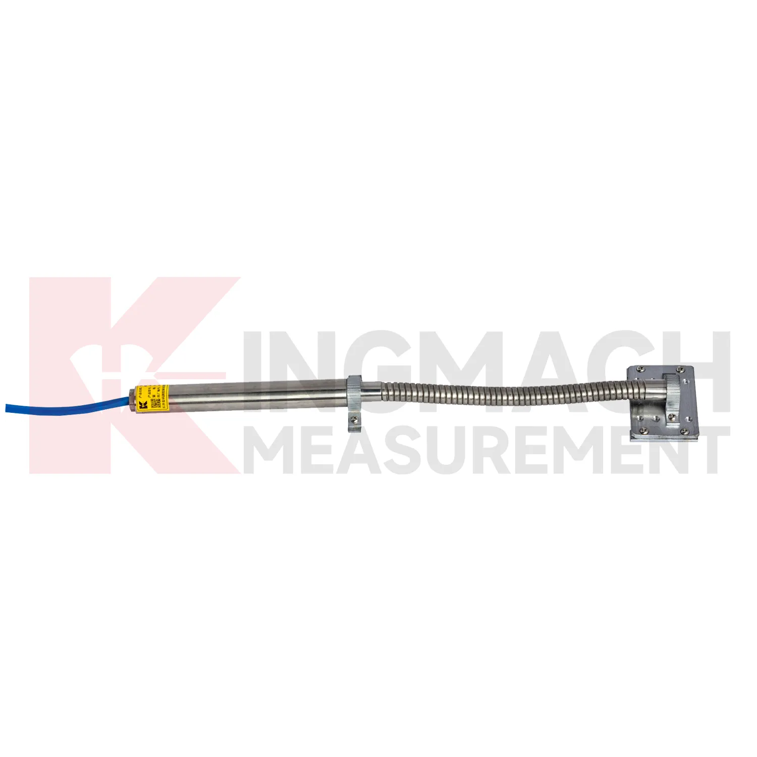
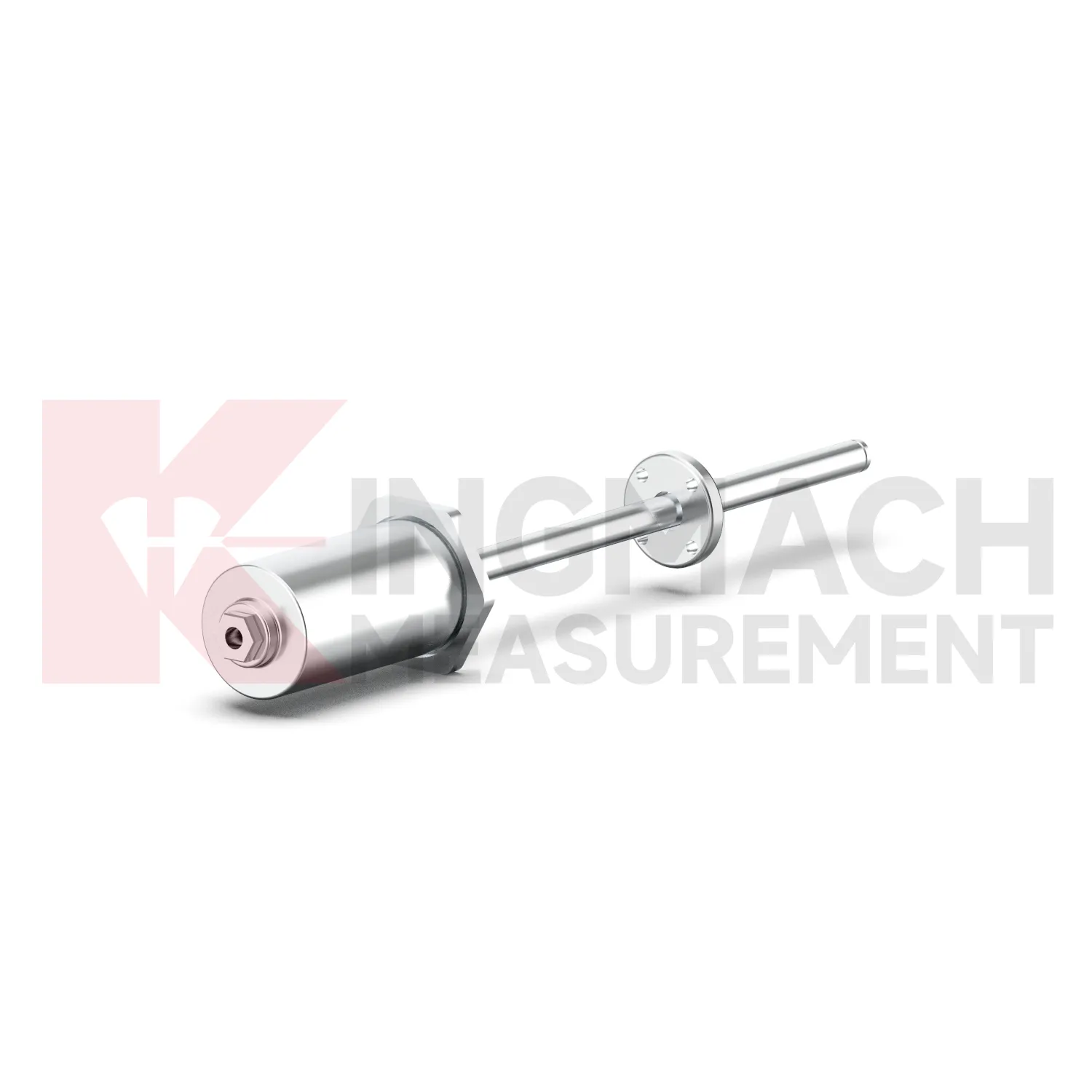
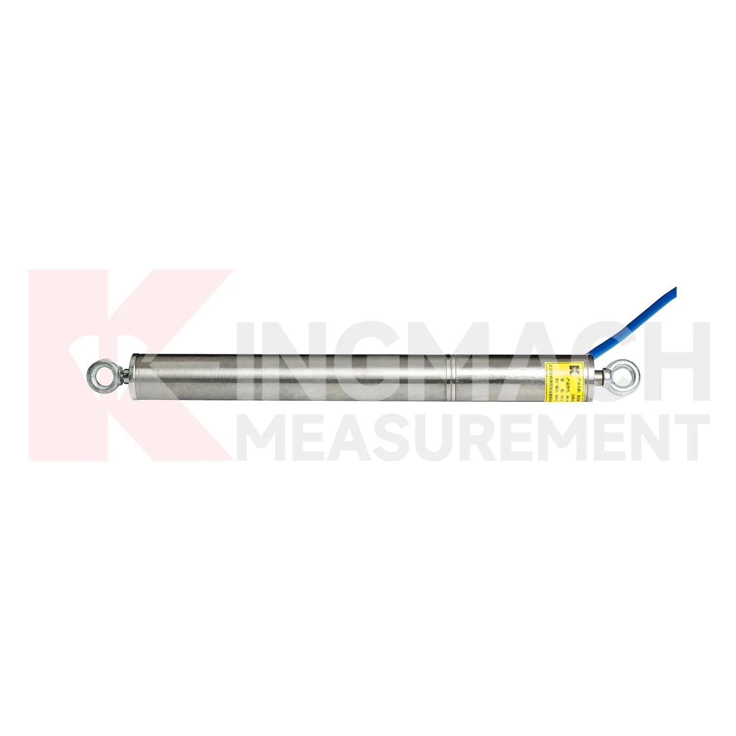
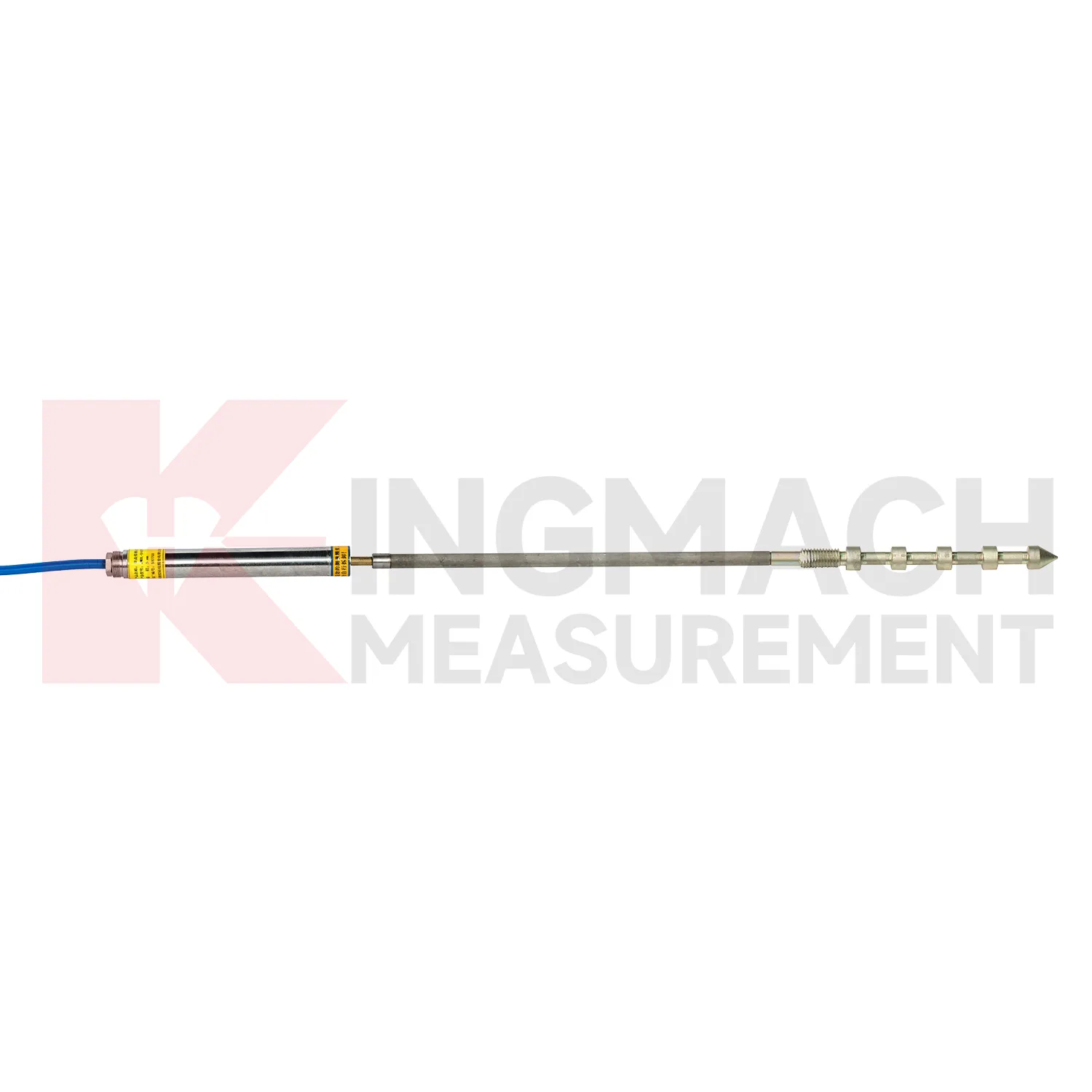
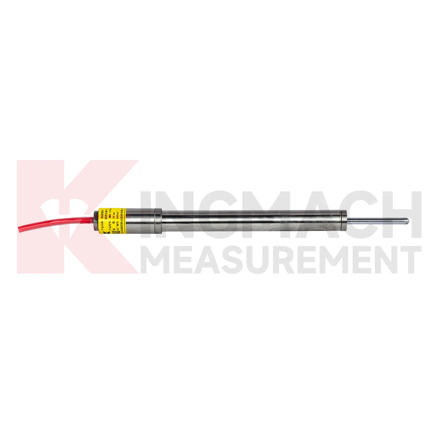
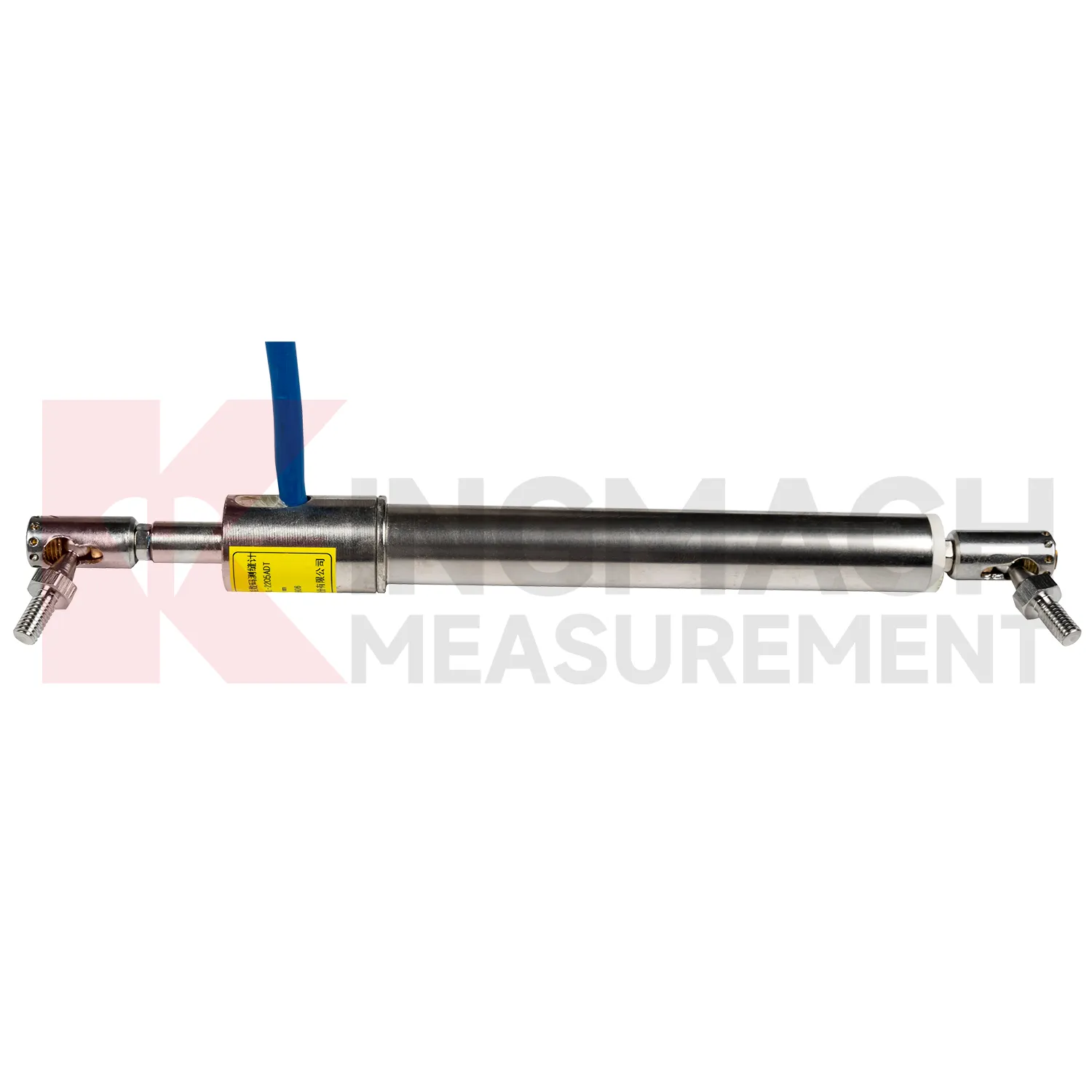
The JMDL-32XXAT Smart Single-Point Bedrock Displacement Meter extends Kingmach Integrated GNSS into embedded rock and foundation monitoring. It is designed for tunnel rock mass deformation, dam bedrock deformation, slope sliding, and foundation pit face movement. The assembly includes a flange, electrical displacement sensor, tie rod, anchor head, and PVC pipe, forming a practical embedded instrument for single-depth displacement. Listed models include 50 mm, 100 mm, and 200 mm ranges, each with 0.01 mm resolution. Product information lists displacement accuracy of 0.5%FS, temperature accuracy of plus or minus 0.5 degrees Celsius, and an operating temperature range from -30 degrees Celsius to +80 degrees Celsius. This product is useful where the monitoring point needs to be anchored into a known layer rather than mounted only on a visible surface. In tunnels, dams, slopes, and deep excavations, that embedded layout helps link surface observations with movement inside the rock or foundation body. During project setup, the measuring point should be matched with the expected travel direction, available mounting space, cable route, and required acquisition interval. This prevents a short-range joint instrument from being used on a long-travel point, or an exposed sensor from being placed where an embedded anchor is needed. It also helps the monitoring team set a baseline that can be defended during acceptance and later maintenance review.
Application of Integrated GNSS
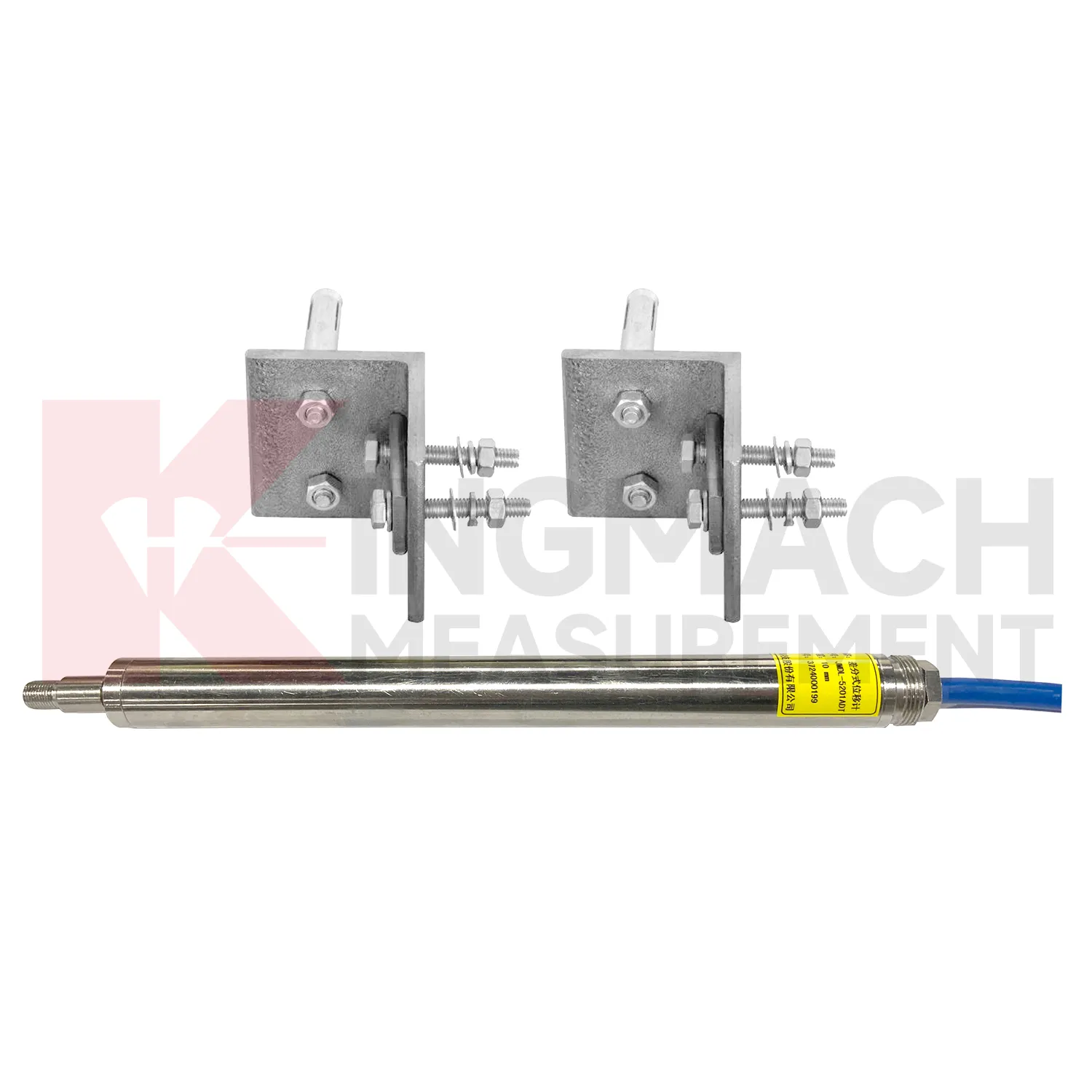
In foundation pit and deep excavation projects, Integrated GNSS are used to watch retaining walls, soldier piles, soil nails, nearby pavements, basement walls, and adjacent structures as excavation stages remove support from the ground. The main site concern is not only how far one point moves, but whether movement grows after each excavation layer, support installation, dewatering step, or backfill stage. Kingmach JMDL-32XXAT single-point bedrock meters can measure embedded displacement at a selected reference layer, while JMDL-22XXAT crack gauges follow opening at nearby structures or retaining elements. JMDL-52XXADT differential meters provide high-resolution relative movement at joints or structural interfaces, and JMLS-22XXADT wire rope sensors can cover longer exposed paths where access is available. A useful pit monitoring plan records excavation depth, support timing, groundwater level, construction vibration, and surrounding building observations beside each displacement curve. This helps engineers distinguish bracket disturbance from real ground movement, and it supports faster decisions when a wall, road edge, or adjacent building begins to respond to excavation. During review, the same point should be compared with nearby settlement, tilt, support force, groundwater, and inspection notes so the movement is interpreted as part of the excavation behavior rather than as a single isolated value. during maintenance.
The future of Integrated GNSS
Future Integrated GNSS will also become easier to install in cramped and irregular field locations. Many monitoring points are not clean laboratory setups; they are narrow tunnel headings, wet dam galleries, crowded bridge joints, temporary formwork frames, steep slopes, and machinery spaces with limited room for tools. Smaller housings, clearer mounting accessories, stronger cable exits, and simpler alignment checks will reduce installation errors. Kingmach already uses several physical formats, including crack gauges with measuring rods and bases, draw-wire sensors for longer travel, embedded bedrock assemblies, flexible geogrid meters, and non-contact magnetostrictive meters. Future product development can make these formats more modular, so engineers select the mounting kit, cable protection, connector type, and acquisition method together. That would shorten commissioning time and make later maintenance less dependent on the original installer. For projects with many measurement points, practical installation improvements can be as important as another decimal place of resolution, because a well-mounted sensor gives cleaner data from the beginning.
Care & Maintenance of Integrated GNSS
Care for Integrated GNSS starts with selecting the correct range before installation. A 20 mm or 50 mm joint sensor cannot replace a 1000 mm draw-wire sensor, and an embedded rock displacement meter cannot be treated like a surface crack gauge. Confirm model, range, resolution, accuracy, mounting accessories, cable length, power supply, output type, waterproof rating, and acquisition method before the instrument is shipped to site. For Kingmach products, check whether the selected model is JMDL-21XXAT, JMDL-22XXAT, JMDL-24XXAT, JMDL-31XXAT, JMDL-32XXAT, JMDL-49XXAT, JMDL-52XXADT, JMCW-21XXADT, or JMLS-22XXADT. During installation, record the zero reading only after brackets, anchors, measuring rods, cable pulls, or grouted points are stable. A rushed baseline can make every later reading harder to interpret, even when the sensor itself is working correctly. Keep the installation photo, point number, zero value, and expected movement direction with the commissioning record for later review. If a reading changes after maintenance work, inspect the base, anchor, cable, and cabinet before assuming the structure itself has moved.
Kingmach Integrated GNSS
Long-term projects need Integrated GNSS that can survive the same weather, vibration, cable pulling, and site handling as the structure itself. Kingmach designs several smart displacement products with built-in memory chips, digital detection, strong anti-interference capability, and direct display through compatible testers. The JMDL-22XXAT crack gauge stores up to 600 measurement results and covers 20 mm, 50 mm, 100 mm, and 200 mm models. The JMDL-21XXAT general-purpose model stores up to 800 records and can save time, temperature, absolute displacement, relative displacement, and zero-point values. These records matter during handover because the original baseline, later shifts, and abnormal readings can be checked without relying only on handwritten notes. For bridges, dams, tunnels, slopes, and buildings, that traceability helps maintenance teams judge whether a movement event is isolated, repeated, or linked with surrounding construction and environmental change. The point should be named on the drawing, linked with its cable route, and checked against the expected movement direction before the first automatic reading is accepted. For daily review, the reading should be compared with nearby points, recent weather, site operations, and any loading event that could explain the movement.
FAQ
Q: Which Integrated GNSS are used for rock layers or bedrock?
A: JMDL-31XXAT multipoint meters are used for different surrounding rock layers, while JMDL-32XXAT single-point bedrock meters are used for tunnel rock mass, dam bedrock, slope, or foundation pit movement.
Q: How many points can the multipoint meter support?
A: The multipoint installation kit supports three to five monitoring points, with anchor heads fixed at different depths by drilling and grouting.
Q: What ranges are listed for these models?
A: Both JMDL-31XXAT and JMDL-32XXAT list 50 mm, 100 mm, and 200 mm models with 0.01 mm resolution.
Q: Why monitor several depths?
A: Different layers may move differently. Separating shallow and deep movement helps engineers judge whether the problem is surface creep, deeper rock slip, or overall mass movement.
Q: What records should be kept?
A: Keep drilling depth, anchor location, grouting date, channel name, zero value, cable route, and first stable reading.
Reviews
Matthew Garcia
Instrumentation cables are durable and perform well even in harsh environments. Will definitely order again.
David Wilson
We purchased displacement transducers and settlement sensors, and the quality exceeded our expectations. Easy installation and reliable performance.
Latest Inquiries
To protect the privacy of our buyers, only public service email domains like Gmail, Yahoo, and MSN will be displayed. Additionally, only a limited portion of the inquiry content will be shown.
Amelia***@gmail.comSingapore
Hello, I am looking for visualization software for monitoring system data analysis. Please let me kn...
Charlotte***@gmail.comUnited Arab Emirates
Hi, we require instrumentation cables suitable for harsh environments. Could you advise on specifica...
Related product categories
- displacement sensor
- laser displacement sensor
- displacement sensors
- linear displacement sensor
- optical displacement sensor
- wireless displacement sensor
- laser displacement sensors
- non contact displacement sensor
- cable displacement sensor
- draw wire displacement sensor
- inductive displacement sensor
- lvdt displacement sensor